
The National Aeronautics and Space Administration (NASA) is contributing its aerial imagery and data to help the earthquake-devastated nations of Turkey and Syria with rescue operations.
According to Bill Nelson, chief of the US space agency, scientists are working hard to give the rescue personnel meaningful information from the Earth-observing fleet. The synthetic aperture radar (SAR) that NASA uses to monitor the earth in all weather situations, day and night, is used.
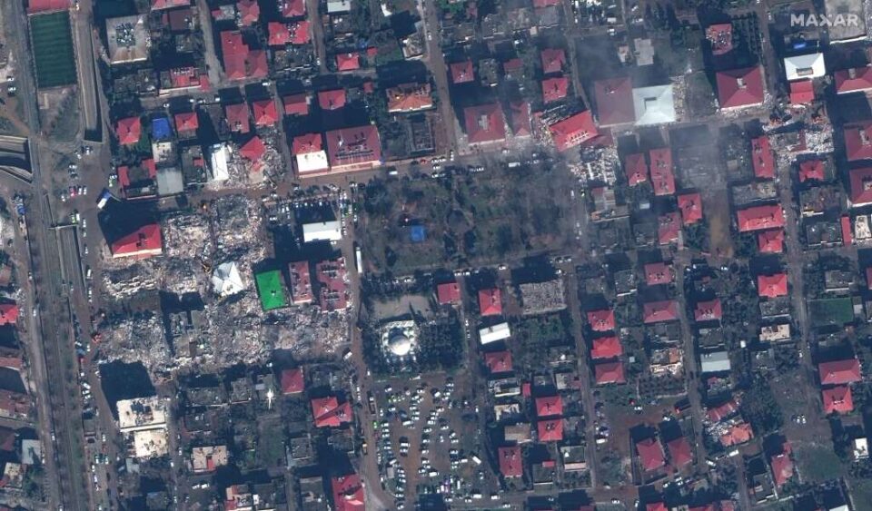
As per information the agency released on its website, it is used to monitor how the ground shifts and the built environment alters after an earthquake. A “damage proxy map” for Turkey was produced by a team of researchers from NASA’s Jet Propulsion Laboratory and the Earth Observatory of Singapore using pictures taken before and after the earthquake.
Also Read: Turkey-Syria Earthquake: Death toll crosses 9000 mark, thousands injured
These intermediate maps compare radar pictures taken before and after the earthquake to show how the terrain changed as a result of the terrible catastrophe. These proxy maps are made accessible to the US State Department, the California Seismic Safety Commission, the World Bank, and the Miyamoto Global Disaster Relief through the agency’s Earth Science Applied Sciences, national, and international collaborations.
The NASA staff members participate in synchronization calls by the US Agency for International Development in addition to providing observations and maps through the Disaster Mapping Portal.
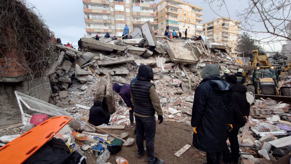
Despite hearing that the World Central Kitchen used the information to supply food to the displaced, NASA’s disaster coordinator for the Turkey-Syria earthquake, Lori Schulz, stated the organization does not know who utilizes the information it disseminates. The ability of the NASA scientists to decode the events resulting from the natural catastrophe is being improved by observations from space and the ground.
The researchers use information from the Commercial SmallSat Data Acquisition programme, that supports NASA’s scientific objectives by using information from commercial satellites. They can identify regions that could have increased landslide hazards.
Also Read: Chat GPT Update: Student passes ‘university exam’ using AI in 20 minutes
According to NASA “The scientists want to add a new tool for assessing the quake’s consequences”. The Earth Surface Mineral Dust Source Investigation (EMIT), which will be launched to the International Space Station in 2022, can measure methane emissions as part of investigations of the composition of the Earth’s atmosphere.